Over the past decade, solar farms have become a common feature of the British landscape with thousands in operation around the country.
Solar farms use photovoltaic (PV) panels to generate energy from daylight and distribute it through the existing electricity grid to homes and businesses in the local area and nationwide.
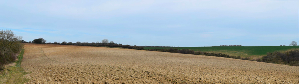
The site at Wherwell Farm along the Winchester Road is located away from the settlement of Wherwell. The maximum height of the entire development is expected to be no more than 3m from the ground and development will be positioned within existing fields so that hedges and trees will not need to be removed.
Solar farms make very little noise in operation and should not be audible outside of the development itself. At the end of its 40 year operational life, the equipment will be removed and the entire site restored to its current use. This will be secured through a planning condition and is part of REPD’s legal obligation to the landowner.
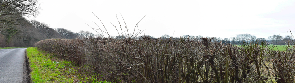
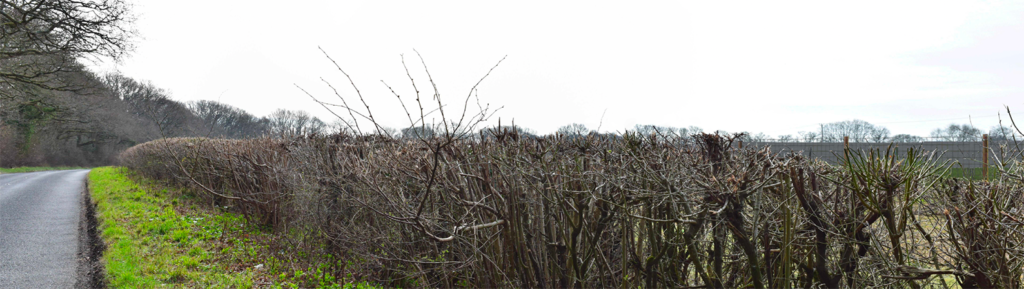
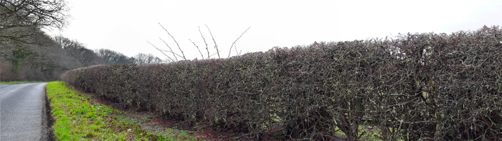
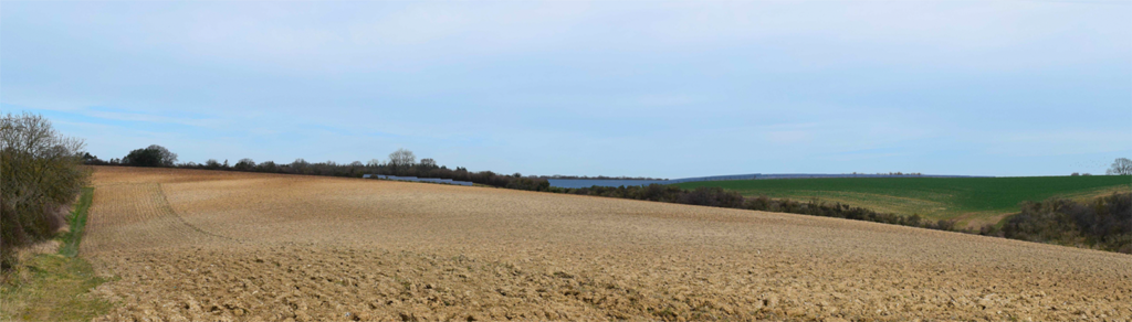
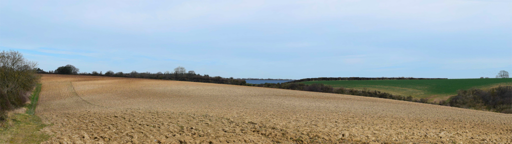
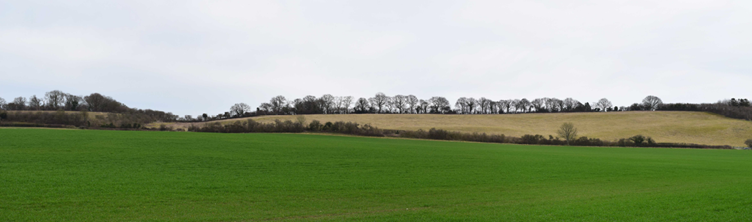
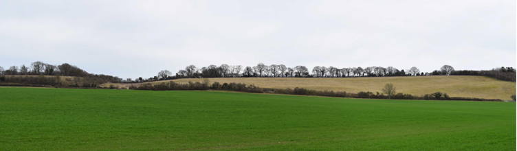
The computer-generated images below illustrate what it will look like from viewpoints across the site. It shows the Current view, Day 1 view post installation of the solar panels and Year 10 views showing the additional mitigations proposed:

Traffic
Once operational, solar farms generate almost no traffic. Visits for maintenance are required every few months. The construction process is rapid, lasting only a few months.
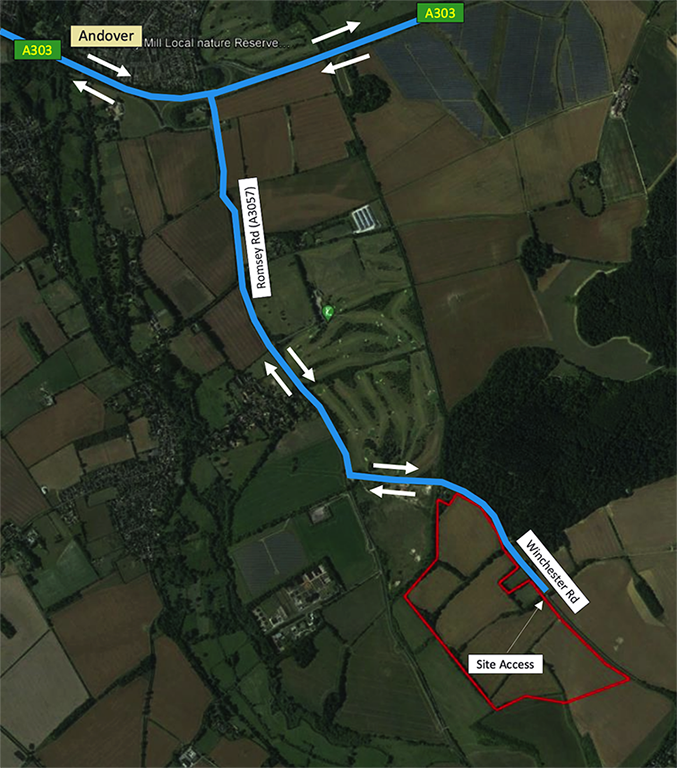
Access into the site by construction vehicles will be taken from Winchester Road. A primary access into a temporary construction compound in Field 3 will be used by all construction vehicles (shown as “Site Access” on the Construction Traffic Plan). This access point will also be used for operational purposes. Construction noise will be kept to a minimum, with operations restricted to normal working hours.
Construction Traffic Plan
Planning Application Documents
Wherwell Solar Ltd have commissioned a comprehensive set of surveys to help determine both the site area, layout and design, so that any potential impacts can be minimised whilst also identifying opportunities to enhance the proposal. These will be presented in a Planning Design and Access Statement to accompany the application. In summary:
- Landscape and visual
impact assessment
This has helped determine the maximum height of the development, the position of equipment, and to minimise the effect of the development on the surrounding area.
- Heritage and archaeology assessment
These have considered listed buildings, scheduled monuments and conservation areas within in the area. The development has been positioned away from Wind Whistle Cottage to the east of the site, and additional screening proposed to reduce visibility, including to Whitehouse Cottage to the north. A geophysical survey has also been undertaken to help assess the potential for archaeological features below the ground.
- Construction traffic assessment
and management plan
Transport specialists have proposed that construction traffic accesses the site from the north, entering the site from Winchester Road, to minimise the impact on nearby villages. The construction period expected to last no more than 25 weeks.
- Arboriculture survey This has identified important trees within and around the site. The findings of this survey have been used to ensure that all important Grade A and Grade B trees are retained and Root Protection Areas (RPAs) maintained, where possible.
- Flood risk assessment and surface water management survey
The site is located within Flood Zone 1 which is the lowest level of flooding. The proposed development will not increase flood risk elsewhere.
- Preliminary ecological appraisal
There are no ecological designations on the site and survey work has shown that the development will not harm the wildlife site, some 0.5km to the south. Following a Badger Survey, buffer zones have been incorporated around identified badger setts. The applicant is aware that deer use the area and so wildlife corridors have been incorporated through the site. Significant ecological enhancements are proposed, including creation of breeding bird habitats in the areas left free of development. 5 skylark plots have been created around the site along with new hedging proposed which will provide a wildlife corridor for protected species across the site. We would welcome your suggestions on how we might improve these proposals.
- Analysis of agricultural land grade
No agricultural land will be lost. The site is currently used for farming and the solar farm designed to allow sheep to graze under and around the panels during operation, providing a dual benefit of agriculture and energy generation. An agricultural land classification survey has confirmed the land to be lower grade 3b, i.e. not best and most versatile land.
Wherwell Solar Ltd will use your feedback to finalise the proposals before submitting the application to Test Valley Borough Council. They will undertake further public consultation before determining the application. The Council has 13 weeks to make its decision